Standing tall at 20,500 feet from the mean sea level, Stok Kangri is the highest peak in the Stok range of the Himalayas enticing both the seasoned climbers and novice enthusiasts alike. It is often considered a window of progression from the non-technical aspect of trekking into high altitude mountaineering involving the use of technical equipment and gears. The Stok range is located at the World’s highest desert – in the Indian city of Leh. This region is, geographically, a rain shadow region of the Himalayas and being at an altitude of about 11,500 feet. And, with lesser moisture in the air the climatic conditions are quite challenging. Having done several Himalayan treks in varying altitudes ranging from high to very-high altitudes, the thoughts of venturing beyond the boundaries of very-high altitude trekking had evoked my mind. Due to its alluring nature of non-technical summit that’s both challenging and intriguing, I decided to sign myself up for this strenuous trekking expedition. A non-technical climb can possibly be achieved only during the summer months of July – August and could extend up to September, beyond which it is practically impossible to scale this mighty summit in extreme winters where the temperatures nose-dive to about negative 30 degrees Celsius. The possibility of scaling the summit in the summer months might sound like loosening up some tough calls, however, the steep climb requires great amounts of physical and mental stamina, the latter one playing a pivotal role in the overall control of your body. At above 14,000 feet, air becomes thin and the amount of oxygen that goes in with each breath begins to plummet. Every metre of altitude gain signals a tough call to the physical exerts that the body has to endure and exercising a strong mental balance helps in attaining that priceless moment at the summit. With all these practicalities to be followed rigorously, I put my onus on physical fitness and mental preparedness for this expedition.
PREREQUISITES:
First things first. There are a handful of health conditions that one needs to be aware of. A careful examination and assessment of it at every stage is a must.
The first and foremost important criteria that serves a crucial deciding factor before proceeding with any high altitude trek is to have your BMI examined. BMI is a measurement of body fat based on your weight in relation to your height. Here’s a handy guide on calculating your BMI:
   Divide your weight in kilograms by your height in meters.
   Divide the answer by your height in meters again.
Ideally, a BMI ranging between 19 to 25 is considered healthy for any high altitude trek.
Secondly, your blood pressure must be normal ranging from 90 to 120 over 60 to 80 millimetres of mercury. I tested positive with both these parameters.
The third criteria is to be able to walk continuously for long duration on steep uneven slope with backpack, adequate amounts of strength and endurance are required. My aerobic fitness started off with extensive physical activity meeting everyday needs that involves walking, jogging, climbing stairs, sit ups, weight lifting and crunches. I carried on with my fitness regime for about 4 months before embarking on this trekking expedition. I was feeling positive with the way my results were shaping up and was pretty confident that I could make it to the summit.
The fourth factor, that could possibly play a spoilsport, is a body condition known as altitude sickness. Altitude sickness is a much broader term. It all begins with what is called Acute Mountain Sickness (AMS), and this could possibly progress to the more severe cases of High Altitude Cerebral Edema (HACE) and High Altitude Pulmonary Edema (HAPE). If these symptoms are not addressed to in a timely manner, it could result in death. The first stage of this phenomenon is known as Acute Mountain Sickness (AMS). It is an effect of high altitude on body and begins to show its symptoms at an altitude of above 8,000 feet. Above this altitude, the atmospheric pressure tends to go lower and as a result you get to breath lesser oxygen. These conditions can possibly be felt by anyone, not just the novices.
On mountains, there are only a few ways to get back to safety. If the aforementioned symptoms are being felt, your fluid intake must be increased and the body must not to be put to any kind of exert. If problems persist, moving immediately to a lower altitude is a wise decision and a life safer.
A FANATICAL TAKE OFF:
High in enthusiasm and with great levels of determination, I started off from Chennai to the capital city of our country on my favorite mode of transport – The Indian Railway! Onboard the Duronto Express I savoured every minute of this 27 hour journey on the fastest train to New Delhi. Upon reaching New Delhi, I met a friend of mine who travelled from Pune for this trekking expedition. We met at the Indira Gandhi Airport, exchanged pleasantries and were waiting to board our flight to Srinagar. A short while after 3 pm, a 90 minute journey landed us at Srinagar – the largest city in the, then, Indian state of Jammu and Kashmir.
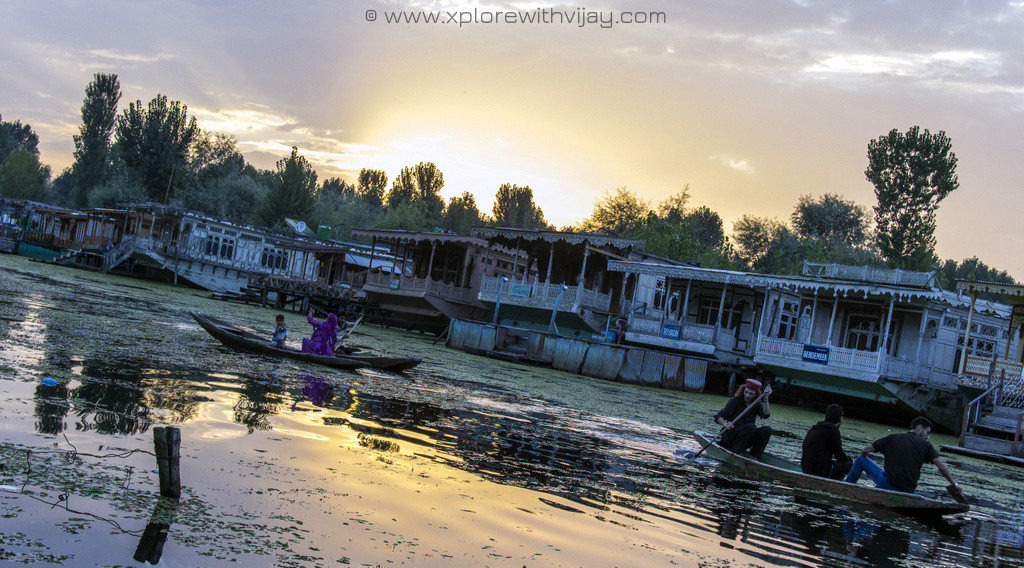
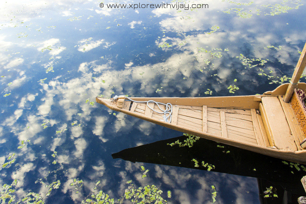
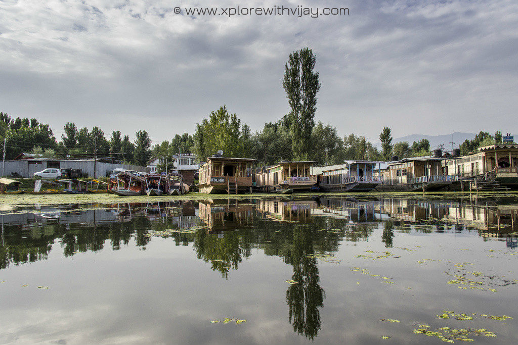
This airport, at Srinagar, belongs to the Indian armed forces and ours was the last civilian aircraft for the day to have landed here. Airports like these, usually, have a regulation of time for the civilian aircraft operations and are typically shut down after sunset. Minutes after the last baggage was collected, we were asked to leave promptly for the airport was about to be closed. We hired a taxi and I was quite excited about our night stay at a floating boat house on the banks of the iconic Dal lake. A boat ride, popularly known as Shikara ride, in the tranquil settings of Dal lake, in the heart of Srinagar, is undeniably one of those nerve calming experiences I have had. With the Zabarwan range in the backdrop, the shadows rendered by the colourful Shikaras floating on the lake and the chirping of birds, it’s one of those remarkably gorgeous locations on planet earth that anyone having a penchant for travel should visit!
ON A FASCINATING HIGHWAY:
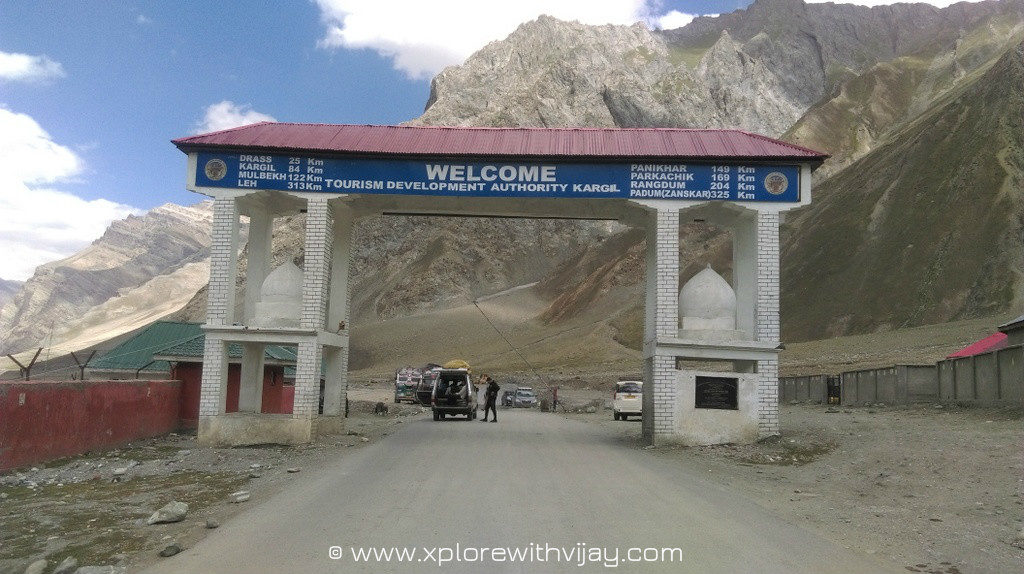
The next morning, we bid goodbye to the serene settings of this beautiful location in Srinagar and hired a taxi to Leh. The road distance is about 430 km on the National Highway 1 via high altitude passes on the way: Zoji La (11,500 feet), Namika La (12,100 feet) and Fotu La (13,400 feet). Here’s a complete road-map we chose to take: Srinagar – Ganderbal – Kangan – Gund – Sonamarg – Dras – Kargil – Lamayuru – Leh. With the highway surrounded by giant mountains, hills, unending water streams and beautiful lakes, the views rendered by this scenic highway kept me occupied by my window seat in complete awe.
After a long arduous drive in the high altitude mountain passes, we arrived at the Kargil city and had a pitstop for our lunch. A quick lunch at this scenic city and we hopped back onto our taxi for a long drive ahead to Leh. There were no interludes for the scenic landscapes kept continuing along the breathtaking mountain passes. Due to low atmospheric pressure and long drive, I did had to confront minor uneasiness. After a long drive of about 14 hours, Leh greeted us with a vast expansive night sky featuring millions of stars. The temperatures were down to about 6 degrees Celsius and we quickly moved over to our hotel.
OVERWHELMED BY THE GEOGRAPHIC AMBIENCE:
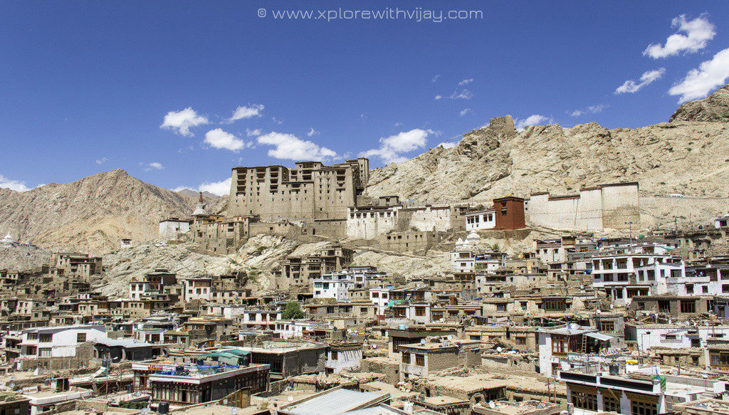
The next morning we met our trek guides and spent the entire day acclimatizing to the weather at Leh. Being at an altitude of over 11,500 feet, it is of paramount importance to get acquainted with the weather conditions before embarking on any trek, failure to do so shall have severe consequences that can even lead to death. We had visits to the delightful Leh market, a few restaurants, window shopping and a few last minute purchases.
THE START OF EXPEDITION:
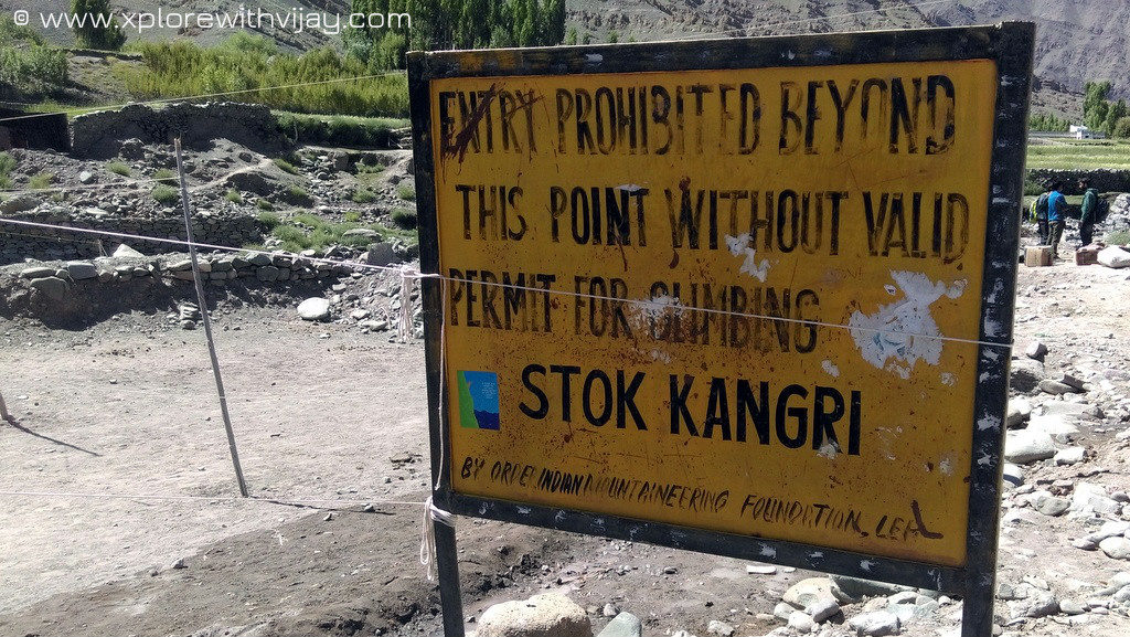
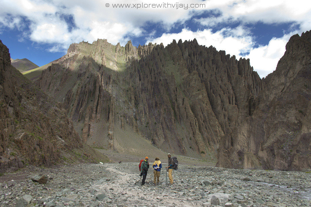
With all the anxiety surrounding the timidness of reaching the summit, we were off to the Stok village shortly – the start of our trekking expedition. We were a small bunch of like minded folks, with regards to trekking and adventure, from across the country. A quick examination of body oxygen levels and the pulse rate for each of us was recorded. And, in a jubilant mood, we stepped forward towards the first camp for the day.
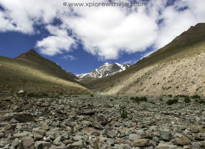
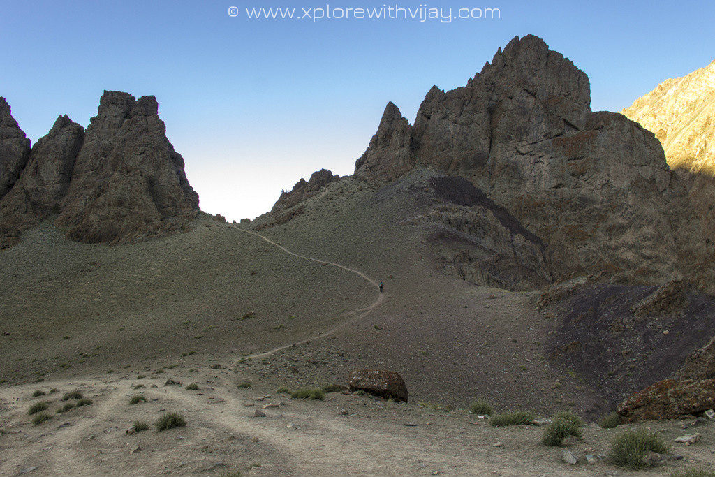
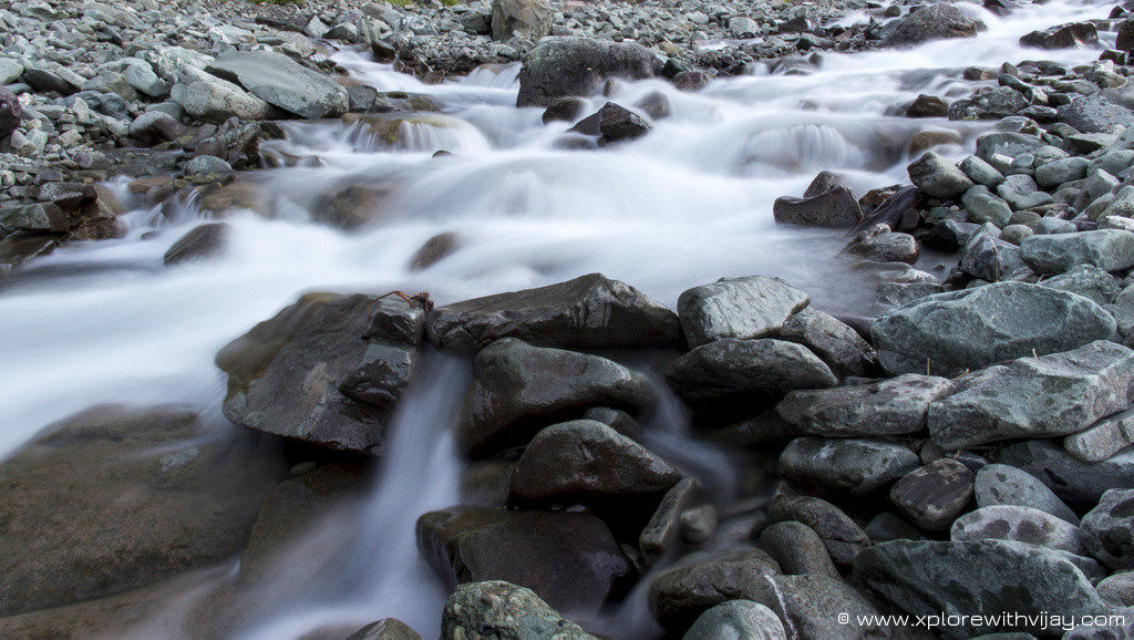
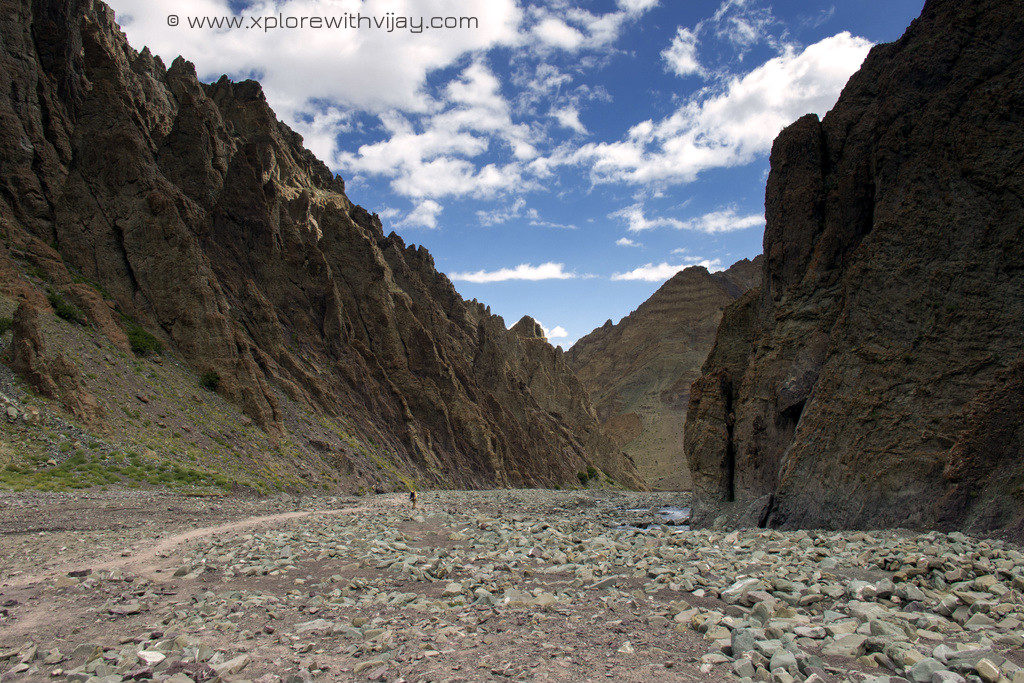
The initial trials were quite steep and it took a toll on my body. However, the magnificence of the barren mountains in the vicinity, the towering Himalayan peaks and ever resonating sounds of the flowing river waters provided the much needed companionship. The dazzling heights and the vibrant colors of the valley was so intriguing that I was constantly looking around capturing the scenes on my camera so I don’t miss out on anything. The views were absolutely breathtaking.
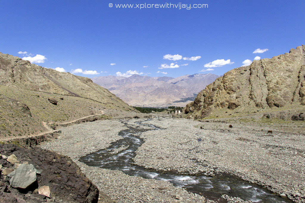
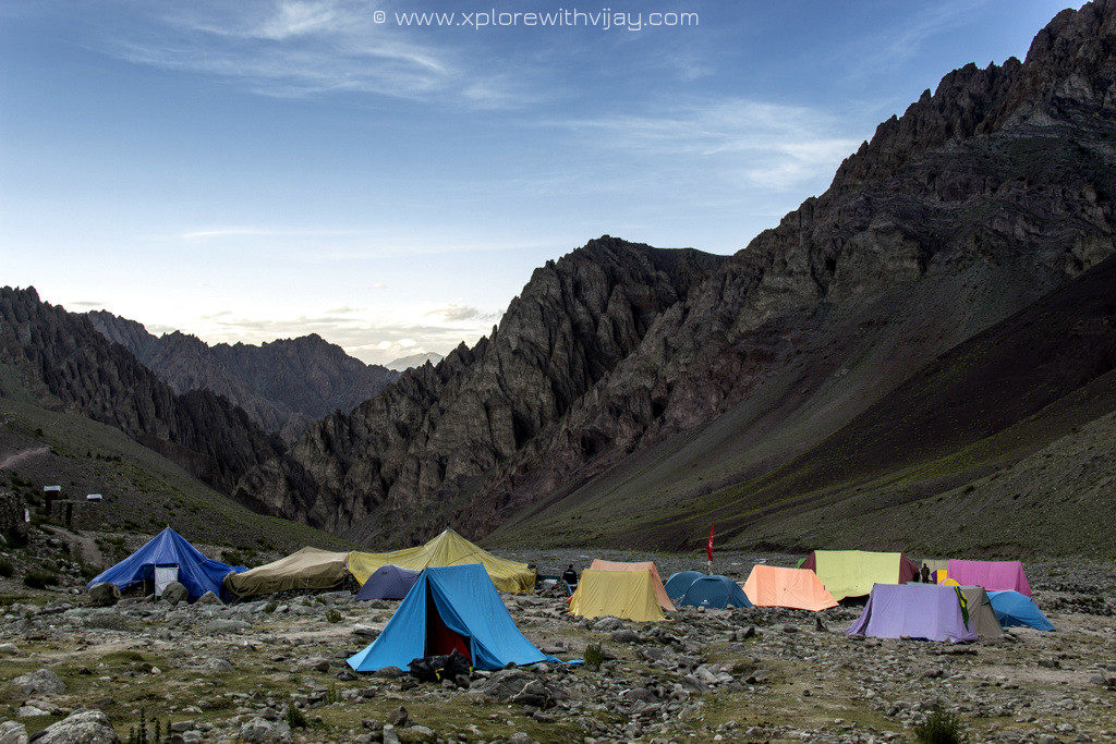
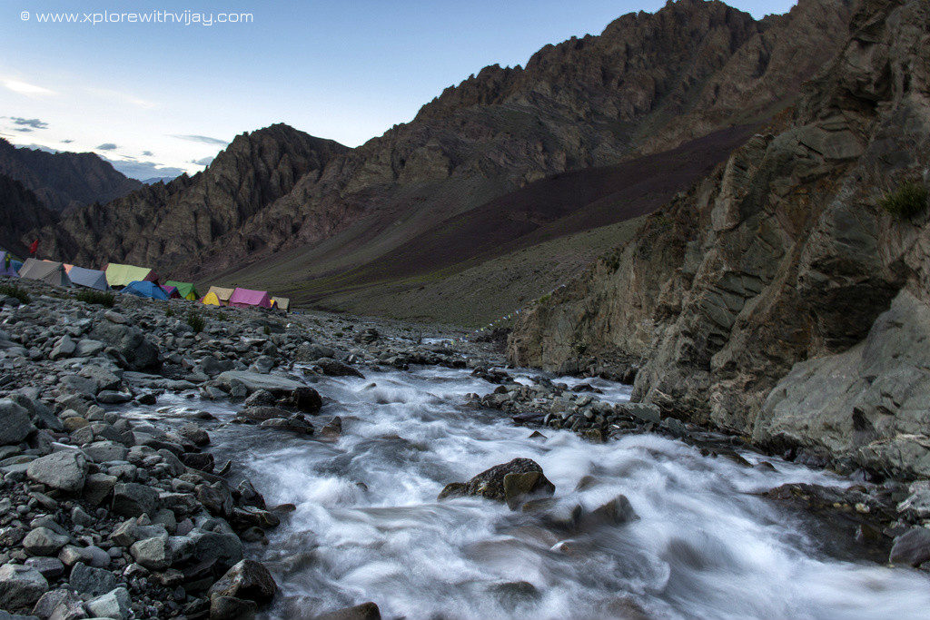
It took us about 4 hours to reach our first campsite at Chang Ma. At an altitude of about 13,100 feet, we set our camping tents by the banks of the Stok river. The camping location were surrounded by the several peaking mountains. We quickly sneaked into our dining tents for a much needed source of energy. It is important to get acclimatized to every altitude. An hour later, as part of our acclimatization walk, we climbed up about 500 – 700 feet and back to camping site for a delicious soup. As soon as I returned, I felt some uneasiness with my stomach and a wave of nausea seems to have engulfed upon me. That’s a clear sign of AMS and I had to pump in enough fluids for my body to process the food. I skipped my dinner and enveloped myself into sleeping bag. At this moment, there was a battle between my heart and mind. My mind sent convincing signals that I must return back, however, my heart was not ready to accept those signals yet. With a rather heavy heart, I fell asleep.
I felt a lot better the next morning. I gathered courage to reverse my mind’s decision and vowed to continue with my trekking expedition. Experiencing an upsurge in my confidence levels, I was upbeat about moving forward.
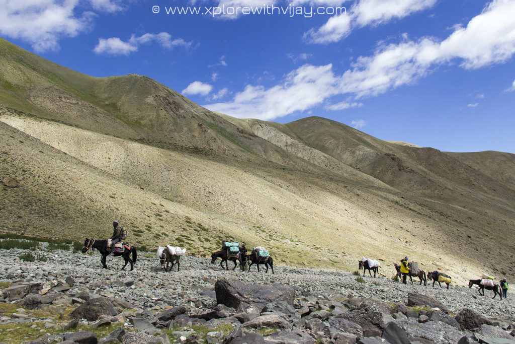
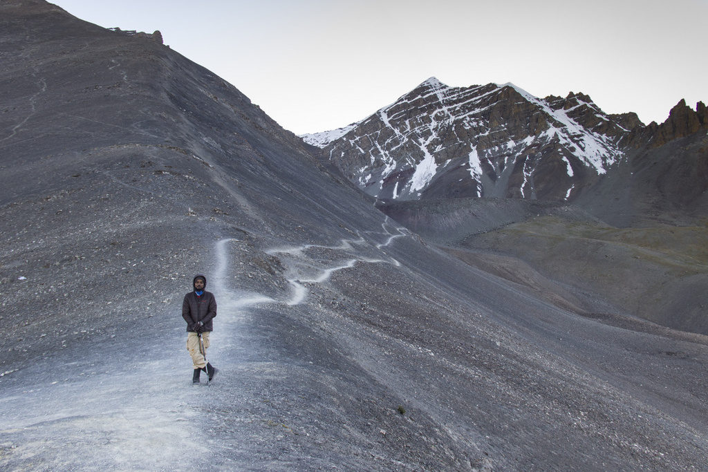
A few hundred meters of uphill trek and here was this place full of rocks and boulders of varying shapes and sizes. Keeping a steady pace and staying hydrated throughout made my day. A 4 hour long arduous trek came to a halt when we set foot on our next campsite at Mankorma. We were at an altitude of about 14,200 feet.
With clear views of the summit of Stok Kangri at a distance, and being surrounded by various other mountains alongside constant sounds of the gushing river waters, this camp was a delightful place to be at. We set up camping tents and were off to the dining tent in a jiffy. An hour later, as part of our acclimatization walk, we climbed up about 800 – 1000 feet. The views rendered around the valley was breathtaking. Shortly around sunset, we got back to our camp for a delicious soup. As the last light for the day disappeared, the temperatures dropped and the conditions were getting harder to stay outdoors.
At high altitudes, unfriendly weather conditions may have severe impacts on health conditions if left uncared for. It is normal to have loss of appetite at such conditions, however, it is of paramount importance to feed yourself any semi liquid food and stay hydrated. This way your body has the necessary resources to keep it going.
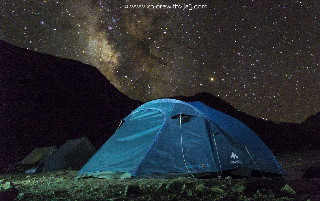
Moments after dinner, while everyone else rushed into their respective camping tents, I was out in the cold and a near-complete darkness made way for an expansive star studded skyline. The night sky had put on a dazzling show of astronomical extravaganza and it was hard for me to resist being confined within my camping tent! With freezing temperatures, I managed to set my camera up and got this impressive shot of the ever beautiful night skies in the Himalayas!
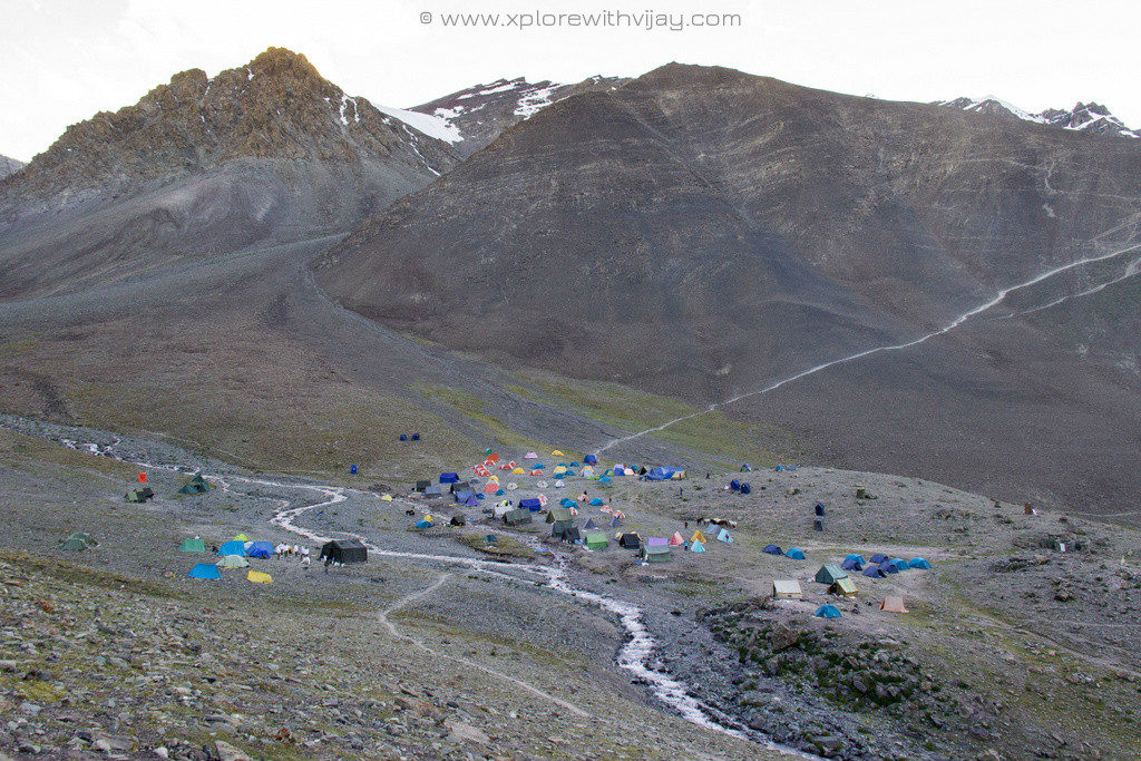
The next morning, we packed up our camping tents and set forth to our final camp for this expedition. We were going to experience a drastic shift in altitude. The steep trails and unending rocky patches kept the going difficult. All through the arduous day, I had to keep my body fuelled up. A four hour intense uphill trek draws to a close when we set foot at the base camp.
At an altitude of about 16,300 feet, the percentage of available oxygen is only about half of what’s available at lower altitudes.
Setting up a camping tent at such altitudes took a toll on my body. I was almost feeling out of energy and my body was in a dire need of intense energy boosters. Although, we were served nutritious lunch, but my appetite had taken severe hit. However, I had to consume them for the benefit of staying energized for the rest of the day. A few hours later, as part of our acclimatization walk, we climbed up about 1000 feet.
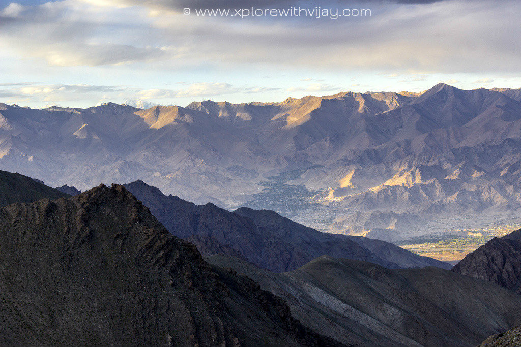
This climb was insanely steep and was extremely challenging. However, the views rendered around the valley was stunning. You get to see views stretching as far as Leh city and glimpses of the the summit of Stok kangri. Shortly around sunset, we got back to our camp and it was time for a delicious soup. Around the same time, few fellow trekkers from our camp had developed severe levels of AMS and were sent down to lower camps to avoid any fatalities. The nights brought with it severe winds and the temperatures were down to about negative 2 degrees Celsius.
The next morning we were briefed about the usage of a few mountaineering equipments such as ice axe, crampons/shoe spikes, and climbing ropes. This briefing was followed by a mock drill that trained us on the aspect of responding to any fatal incidents that could occur while ascending and/or descending by mimicking the actuals. This was an off day meant for rest. So after the briefing we were off to our respective tents. At about 9 pm, we buckled up with our respective backpacks and set forth on our mission to scale the mighty summit of Stok Kangri.
There was complete darkness all around and with our head torch turned on, the only visible section of the mountainous trail was the path we were walking on. Of all those paths that we had to take, walking on a ridge was precariously a risky affair. The severe winds and low atmospheric pressure had an exhausting effect on my body. Three hours of steep ascend and we were at the Advanced Base camp – at a staggering altitude of 18,500 feet. The clock ticked past midnight and the winds were only getting intense.
Few fellow trekkers that weren’t able to keep up their pace with the rest of us were asked to return back to campsite. We were, now, reduced to just 3 members. Further ahead, we had to put on our shoe spikes to walk over the glacier. Though it sounds exciting, it was an arduous task requiring huge amounts of stamina. I was feeling the wrath of bodily exert and beginning to feel out of energy. With frequent stops, I lost my pace and had to find my way to the actual trails in complete darkness. I had reached an altitude of about 19,000 feet and my mind had already begun sending constant intimations, at regular intervals, towards extreme exhaustion. I had been overlooking all those essential hints in the interest of my desire to reach the summit.
Then came a point where I could no longer afford ignoring those crucial hints. I had to abide by what my mind says and return back before any fatal incident could occur. With a rather heavy heart, I had to return back to the base camp. The way back was no easier task. I had already lost heaps of energy . With nausea and low levels of energy, it was only getting worse. After hours of downhill trek, I reached my camping tent at about 6 am. Completely exhausted, I fell asleep and was back up only by lunch. After an extended period of resting, I was able to regain partial energy only to perform minimal actions of standing up on my feet and walking short distances. Such were the loads of exhaustion I had to endure the previous night. By dusk, I was beginning to feel firm on my feet and was able to move around with ease. We had to spend another cold night at the base camp here before beginning to descend.
The next morning, we were excited about getting back to Leh. To spend a week in the mountains, cutoff off from all types of comforts, it was no easy task my any means. There are only a few people on this planet that relish such moments. Back in our camping group, few of us were craving to get back to civilization. Shortly after our breakfast at Base camp, we started off our descend with a stop over for lunch at Chang Ma. A hot bowl of spicy yet delicious noodles and we were brimming with energy.
We ended with reaching the Stok village by the strike of 3 in the afternoon. A short ride to our Hotel and there was a sense was being laid-back at reception. Though, I could not make it to the summit, my maiden attempt at scaling THE HIGHEST TREKKABLE SUMMIT IN INDIA had indeed come to fruition. Standing tall at about 20,500 feet from sea level, it was never an easy task even for an experienced trekker. Nevertheless, I have been able to overcome the many obstacles on my path and was almost on the verge of summit of this beautiful mountain that’s both intimidating and dominating along the ever magnificent panoramic views of Leh!
Reaching an altitude of about 19,000 feet is no ordinary effort and I am contend about it.
RESOURCES:
HOW DID I TRAVEL?
If you have scanned through my other blogs here on my website, you could probably interpret the way I would have planned my travel. Nevertheless, I am a rail fanatic. I am exceedingly obsessive about train travel and I always look for an opportunity. Here’s how I planned my travel:
ONWARD JOURNEY:
- Chennai to New Delhi on board Duronto Express
- New Delhi to Srinagar by Indigo
- Shared taxi from Srinagar to Leh
RETURN JOURNEY:
- Leh to New Delhi on board GoAir
- New Delhi Chennai Jet Airways
POSSIBLE TRAVEL OPTIONS:
BY AIR:
If you have plans to land at Leh, there are a multitude of available options. There are a number flight services being operated from New Delhi to Leh. Give priority to the first flight for the day and get your window seats towards the left.
BY ROAD:
You get to choose from two options:
MANALI – LEH: This is one of the most scenic and popular routes. The total distance is about 490 km passing via 5 high altitude mountain passes, including that of the popular one – Rohtang pass. You will need at least 2 days, with adequate stops for rest, to reach your destination. Also, having a buffer day is always beneficial. On mountains, plans do not always get executed to perfection.
SRINAGAR – LEH: This is yet another scenic driveways that will remain memorable for years to come. The road distance is about 430 km on the National Highway 1 via high altitude passes on the way: Zoji La (11,500 feet), Namika La (12,100 feet) and Fotu La (13,400 feet). Here’s a complete roadmap we went through: Srinagar – Ganderbal – Kangan – Gund – Sonamarg – Dras – Kargil – Lamayuru – Leh. The duration of travel will be around 14 hours and can be done on a single day.
You have the following options at your convenience:
JKSRTC operates buses from the tourist reception center near Dal lake, departing typically at about 8 am. It will be a journey of two days with a night halt on day 1 at Kargil and arriving at Leh the following afternoon or evening. Depending on the type of service you choose, the maximum fare shouldn’t go beyond INR 1,300.
Private taxi – This is more of a luxury option and works well only if you have a group of at least 7. The cost per taxi is INR 15,000.
Shared taxi – This is the most cost effective yet fastest way to reach Leh. You will be charged a nominal fee of INR 2,000 and not exceeding INR 2,500
MOBILE CONNECTIVITY AND OTHER ESSENTIALS:
Make sure you carry a postpaid SIM, specifically from BSNL. Prepaid cards issued outside of the state of Jammu and Kashmir are not operational. Predominantly, BSNL and Aircel are the only networks available here. However, while on the highway your mobile phone is just a piece of entertainment device. The mobile networks may or may not always be available until you reach Leh.
There is no dearth for fuel stations. There a quite a few all along the highway. However, make sure to fill your tanks at Srinagar.
ATMs are available at Srinagar and midway at Kargil. ATMs of major banks are lined up at these locations.
I hope, someday, this information may be beneficial for you to plan a trip to Leh. Let me know if you liked this blog in the comments section below.
Feel free to share this blog with friends. Hit any of those social media icons to share this blog!
And, do subscribe to my travel blogs at https://www.xplorewithvijay.com, So you don’t miss out on fascinating travel stories.
Speechless… I wish to Experience it once!!
Thank you, Anjana! The mountains are always there! Experience it anytime! 🙂
You are truly amazing…What a way of writing !
Thank you, Murali! 🙂
Beautifully described the arduous trek to Stok kangri …when I went way back in 2007 it was much more daunting beacabe of the equipment, porters etc..nice keep up the good work
Thank you very much for that amazing feedback! I am delighted! 🙂
It beautifully described the trek to Stok ….
Detailed and beutifulbea written … explains everything about the Stok kangri Trek
Thank you very much for that amazing feedback! I am delighted! 🙂