Closed lanes…
Large contingent of armed forces deployed across various locations in the city..
And round-the-clock media coverage…
Sounds familiar?
Just as the world is reeling under the deadly influence of COVID-19 that originated from China, what’s coming ahead in this blog has a Chinese connection too. Don’t panic, as it is a mere coincidence that I chose to pen down on a memorable Himalayan experience I took up a few months ago. So, sit back comfortably in your couch and savour a virtual Himalayan journey with me!
Day 1 – The Inception:
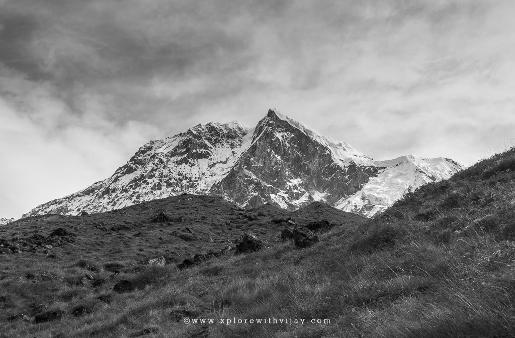
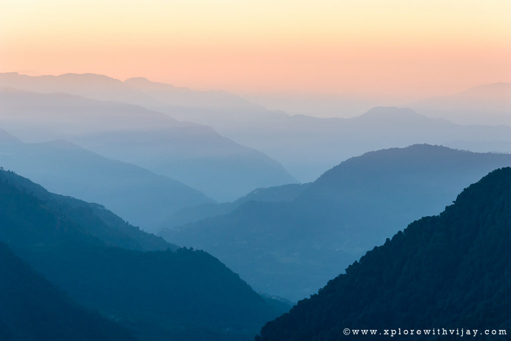
When one begins visiting Himalayas, it’s a start of a fascinating journey with no end to it. The alluring nature of these majestic natural formations will entice you to visit time and again! My first Himalayan journey dates back to the year 2015. And, since then, I have been visiting these spectacular mountain ranges on the planet every year. A lot of preparations go in with each such trek. The very first activity is to identify the range. The Himalayan Mountain range is vast and it runs from west-northeast (Gilgit-Baltistan in Pakistan) to east-southwest (Tibet Autonomous Region in China) across massive distance of about 2,400 km. Typically, I look for picturesque landscapes with wider scope for capturing the many spectacular mountain peaks. The time of visit is a crucial factor too. After a lot of analysis, I decided to visit the Eastern range of Himalayas. Situated in the north-eastern Indian state of Sikkim, the spectacular Goecha La trek, at a staggering altitude of 15,100, feet is always a mesmerizing experience! What’s more exciting is that a major part of this trek is along the path overlooking the massive Kanchenjunga range of mountains, the third highest mountain in the world!
After weeks of both physical and psychological preparations for the trek, it was the day of intense excitement and few anxious moments. October 11, 2019 will remain etched in my memory for many years to come. It was a day when Tamil Nadu played host for a meeting between Indian and Chinese delegates. Indian Prime Narendra Modi and Chinese President Xi-Jinping were set for an informal meet in the coastal town of Mahabalipuram. On this account, major arterial roads were closed, thus, causing public inconvenience. With a necessity to get on to the streets for my 5 AM flight next morning and sensing additional layers of security at the airport, I decided to arrive early at the Chennai airport. 1 past midnight, I managed to hire a taxi to the airport. The scenes on the road were unbelievable, something I have never seen in all my years of stay in the city! There were hundreds of armed forces (both central and state), and bomb-disposal squads actively involved with their respective duties. And, this extended several miles all the way up to the airport.
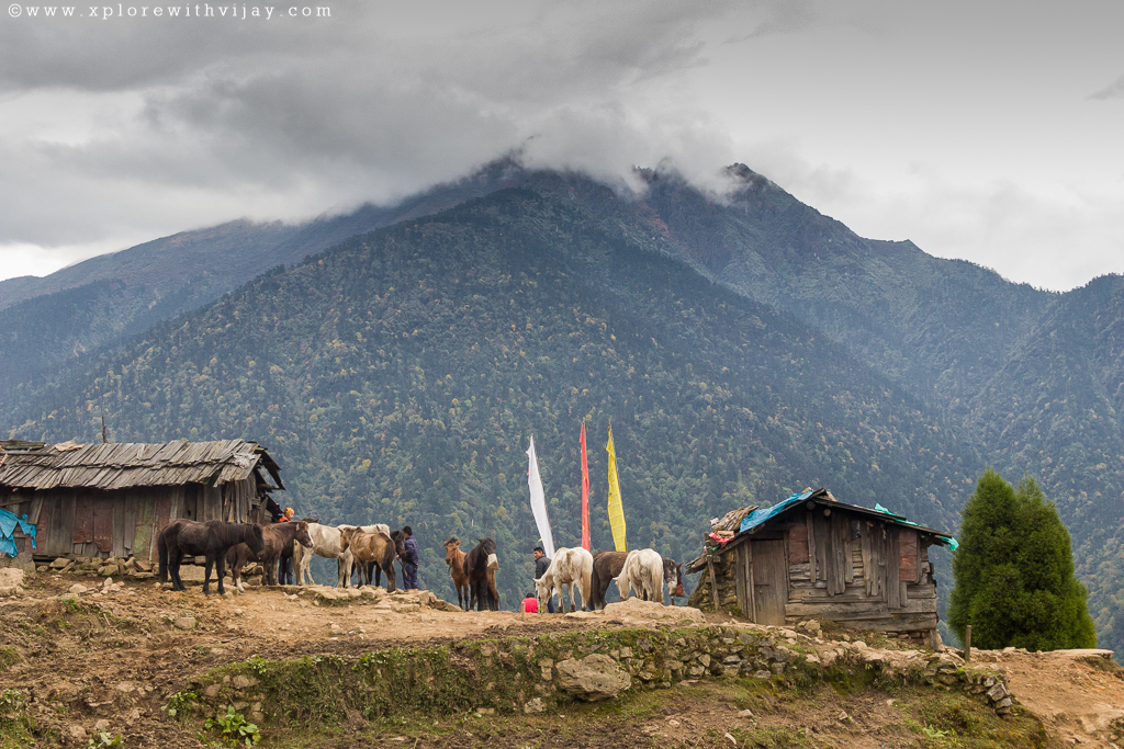
At the airport, an unusual calm prevailed. The last domestic flight for the day had departed and hence, the airport staff grew thinner. I thought, a short nap could be a good enough rest for a long journey ahead. Within no time, I fell asleep in sitting posture. Later, a 3-hour long flight brought me closer to the destination. The airport at Bagdogra, in the Indian state of West Bengal, is a non-civilian airport, and hence the passengers were instructed to strictly abide by the airport rules. Here, I was joined by few others from the trekking group, arriving from various cities across the country! After a brief exchange of greetings, we brisked our way to New Jalpaiguri Railway station (a distance of less than 3 km) to begin our long road journey to Sikkim. With the arrival of every member of the group, except one, a 150 km drive to Yuksom (former state capital of Sikkim) began. At the border town of Melli (crossing between the two states), due permissions were obtained from the police station. It’s a formal paperwork involving filling up basic information along with passport size photographs! After a 9-hour long drive, we were greeted by the calmness and chill weather of Yuksom (our base camp at an altitude of 5,800 feet). This is the last destination for picking up any essential items. Going forward, there are no villages/shops. With the night setting in, the cold breeze kept us all confined to a well packed dormitory like settlement!
Day 2 – Exhilaration & Bliss
A much-needed overnight rest, especially after a long drive at high altitudes, was a blessing. A pleasant morning greeted all of us! The entire team was briefed by our Trek leader on basic guidelines and what to expect through the duration of the trek! Also, we were introduced to the Head of support staff. You will get to know about him in the later sections! He is one interesting character! And, after a sumptuous breakfast we set forth on our journey! A magnificent and memorable one, indeed!
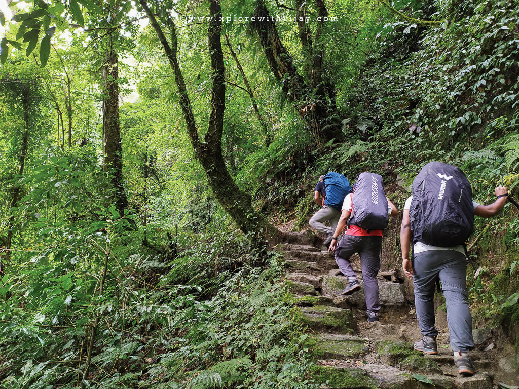
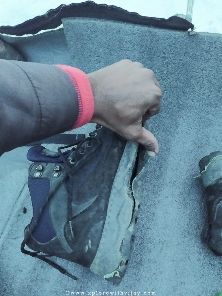
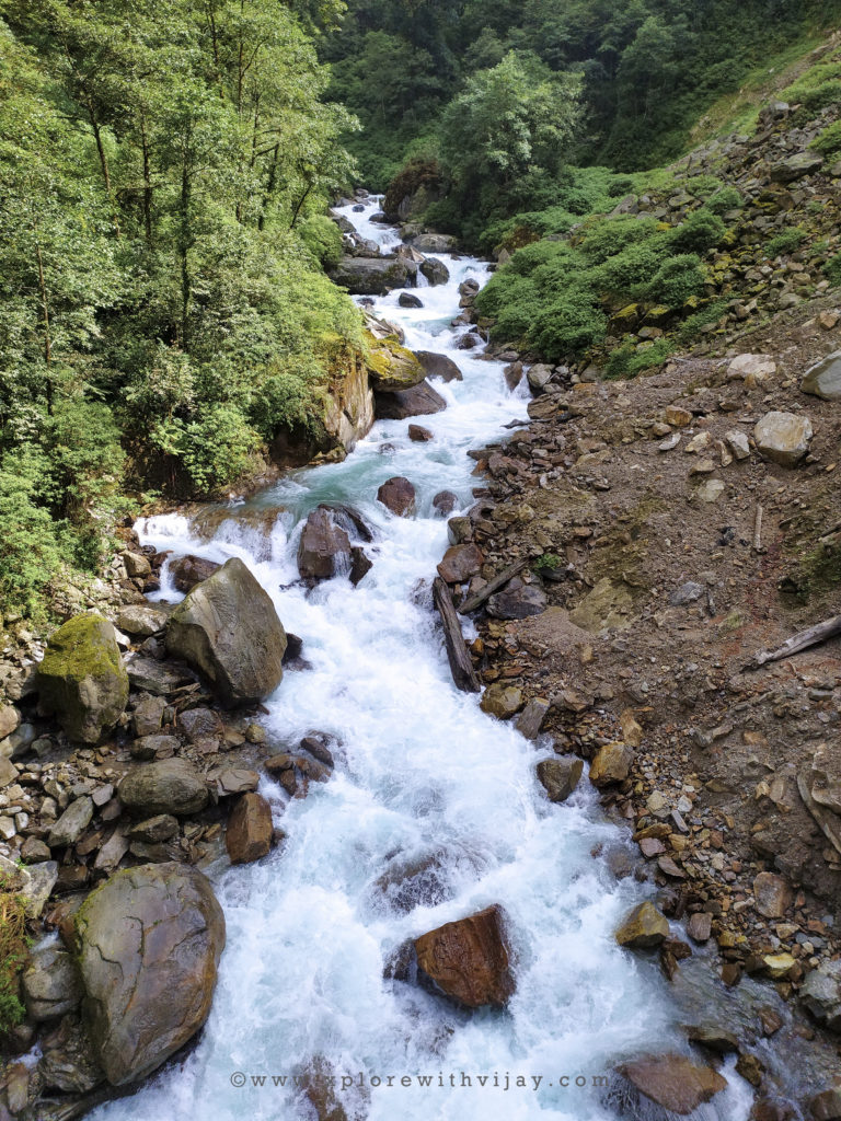
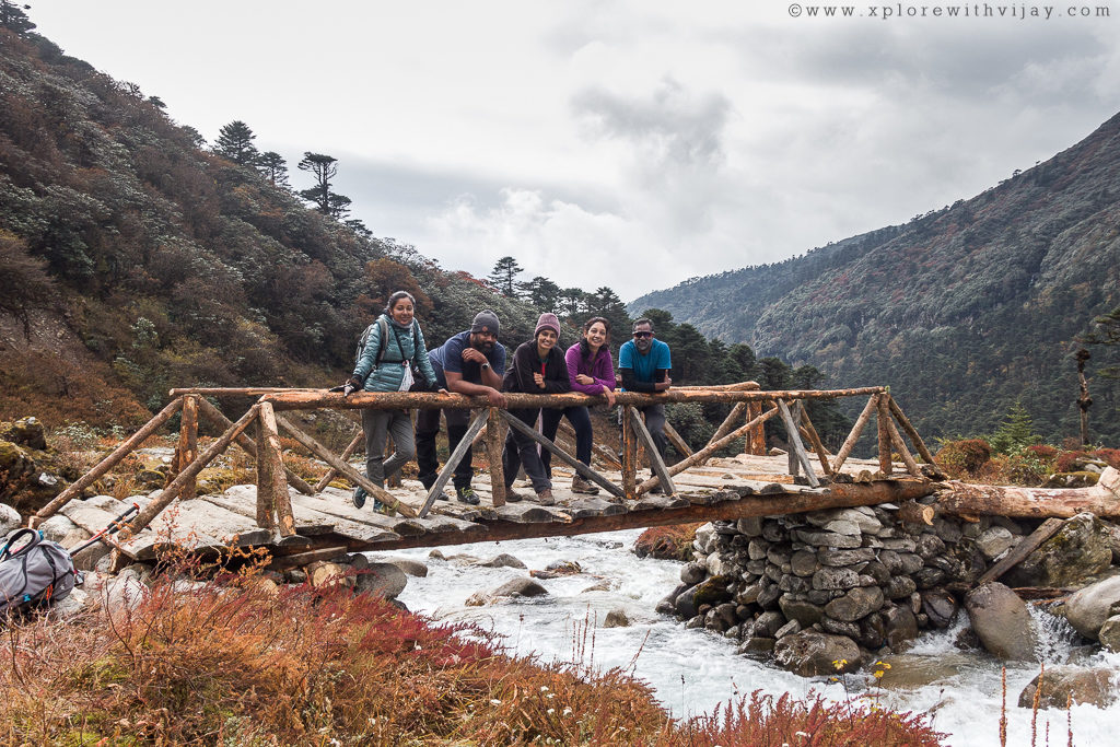
Our destination for the day was to reach the next higher camp, Sachen, at an altitude of 7,200 feet. It’s at a distance of about 8 km. The initial few meters of trail were fascinating with sights of local settlements. Within no time, the trail guided us to the forested lands and is a mesmerizing tale of experiencing nature! Trudging through numerous suspension bridges at dizzying heights, watching plenty of rivers and hearing the sounds of gushing streams, it was reinvigorating to both the sensory organs and psychological health! Half way through the journey, my trekking boots got ripped apart. The soles were badly damaged and beginning to wear out. Luckily, a group member offered an adhesive that helped serve a temporary relief.
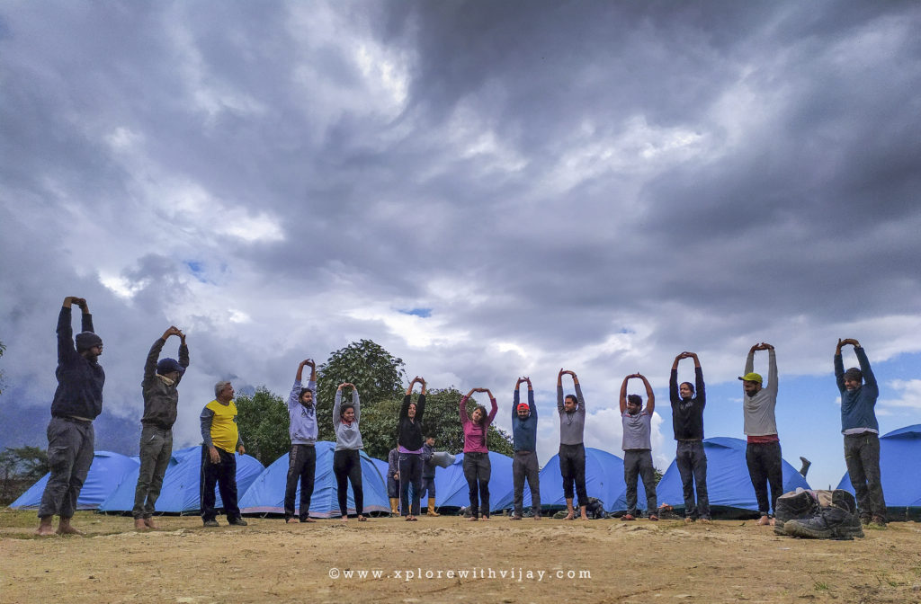
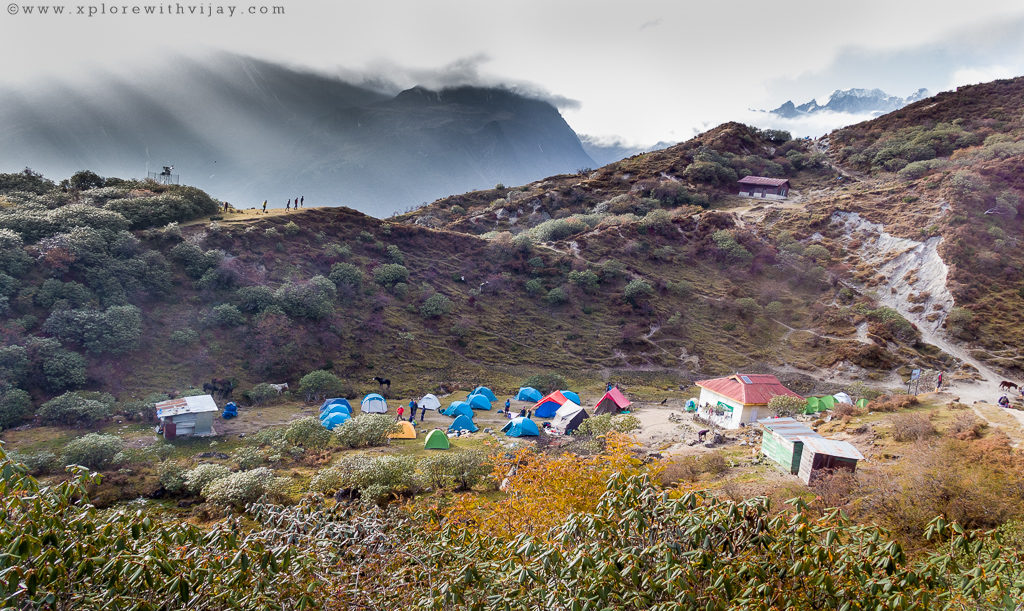
An 8-hour long arduous trek came to a halt at a campsite that’s densely covered with plantations all around. We were, now, at an altitude of about 7,200 feet. The clocks seemed to be ticking way too slower. It was only 4 PM. With plenty of time in our kitty, it was time for some stretching exercises. This activity cools down your body, reduces any stiffness of muscles, increase its flexibility thereby reducing the risk of any injuries. You know, getting injured while on a trek is a distress.
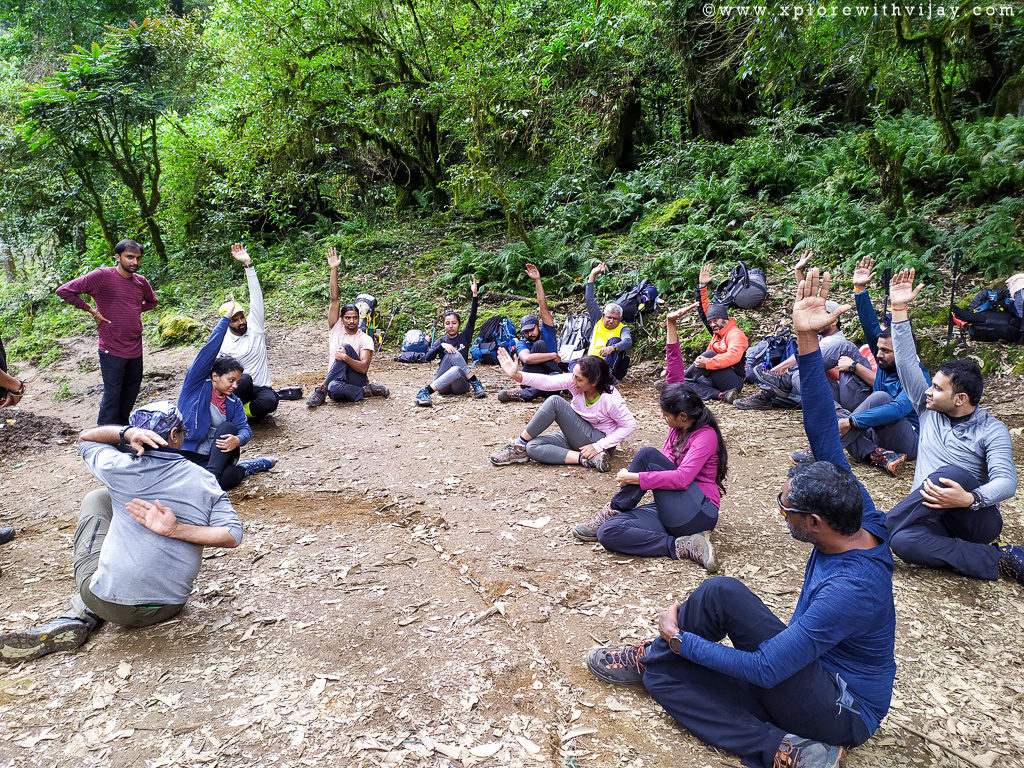
Now, comes an interesting part. A group member, Deepali, has been teaching Yoga back home and she offered all of us perform some simple yoga poses to get rid of any bodily pains. Later, we had another engrossing activity. It was her again. This is something I loved. Because for a person like me, there was no way to easily approach the other person. And, remembering the name of every other person is a different game altogether. I have an introverted personality and is normal to not socialize. However, this activity rekindled my hidden personality. This was a game, played on a round-robin fashion. A person begins identifying every other person’s name and where the other person hails from. Luckily, I wasn’t the first one. It was my good friend, Dinesh, who started the proceedings. As the game progressed, I was beginning to grasp the names and cities of the respective members. It was a sigh of relief when I did manage to name each of them! With the fall of dusk, the temperature was beginning to drop. A pleasantly cold weather persisted. A quick and sumptuous dinner followed and we were off to our respective camps!
Day 3 – Ecstasy:
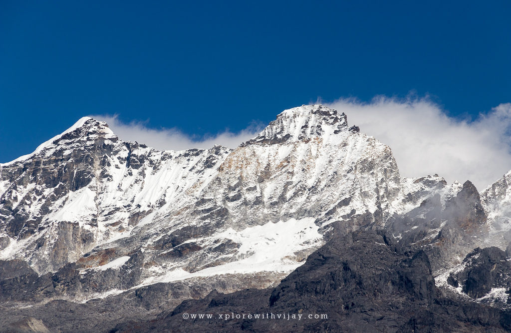
A not so comfortable sleep woke me up for a long day ahead. Typically, the first camp is where one gets habituated to using sleeping bags and find a comfortable sleeping posture. The next destination was at an altitude of about 9,700 feet. Though the hiking distance is only 7 km, it’s a steep climb. About a km from Sachen camp is an enticing iron bridge over a river. Watching the gushing river waters flow in all its rapidity from the dizzying heights of the suspension bridge is sure to make you spellbound! As soon as you cross this bridge, there’s a steep incline and it takes a toll on your body. It’s strenuous, arduous, and back-breaking. However, upon reaching our midway point of Bakhim, all those hours of toil and physical exhaustion disappeared. It’s not just a relief to the physical pain, rather a feast to the eyes as well. Bakhim, at an altitude of 8,600 feet, offers impressive views of Mount Pandim and Mount Tenzinkhay.
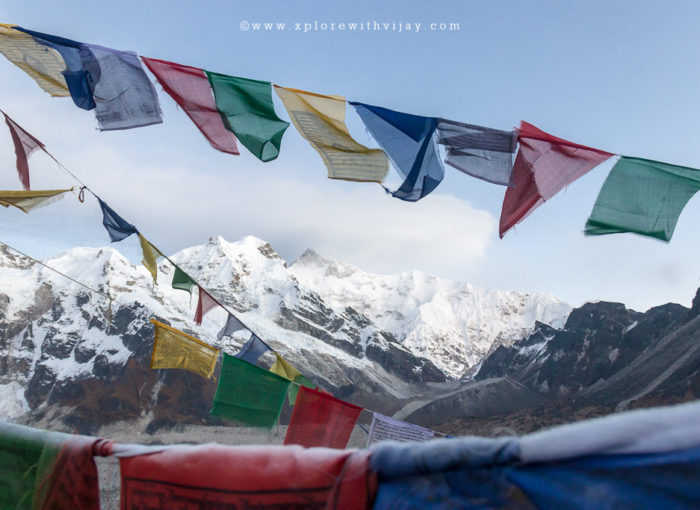
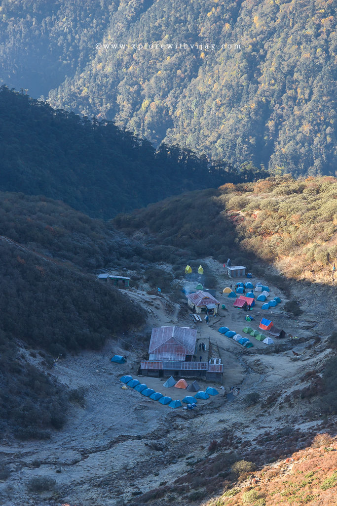
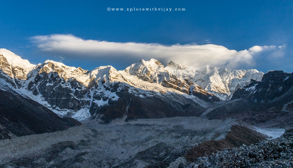
Owing to extreme physical exhaustion and rapid consumption of fluids, it is important to carry additional quantity of water until reaching the next campsite. My friend, Amit, and I collected a bunch of water bottles from fellow trekkers and went in search of nearby water streams to collect water. A short rest at Bakhim, and we resumed our hike towards our higher camp. The journey ahead was both a mix of steep ascends and occasional descends. After an arduous 7 hours of toil, we conquered 9000 feet. The camp at Tshoka is on a plateau offering fascinating views of snow clad Himalayan peaks with the likings of Mount Kanchenjunga and Mount Pandim. I must say we were lucky to see these peaks. There was a heavy cloud cover and the visibility was poor. However, mother nature had plans for all of us! Moments before the last light of the day could fade away, the cloud cover moved away for a brief moment. This offered magical views of the distant peaks! This campsite at Tshoka is among the best of all the camps.
Day 4 – Elation:
A comfortable night’s sleep is something that can be felt and experienced the next morning. You feel lot more energetic and, most importantly psychologically more active. This is exactly how I felt. Today’s day was going to be the most grueling of the trek. More than the climb, the weak shoe soles kept my worries alive. The next higher camp is at an altitude of 12,980 feet. That’s over 3,000 feet from the current camp. The first few kilometers are rocky terrains combined with a steep incline. Enough care must be practiced with each step as there’s a high probability of getting injured. Among the most common types of injury is an ankle twist. And, it’s the worst place to get injured. In case of extreme pains or any other type of severe injuries, getting back to the base camp is a lot of pain. With my shoes broken, I had to pay extra attention with each step to not slip away/lose balance thereby keeping the shoe sole intact. After an arduous 5 hour of toil, we were again treated for a visual feast. The viewpoint at Phedang (at an altitude of 10,500 feet) offers scintillating views of snow clad peaks in the distance.

The rocky terrains end here and are followed by paved wooden logs, extending up to the next higher camp. A 10-hour long hike brought us to the campsite of Dzongri (at an altitude of 12,980 feet). Having climbed over 3,000 feet in a single day is an invitation for altitude sickness. However, with proper hydration and hiking procedure, the ill effects of altitude gain on physical body can be negated. Typically, sipping water at regular intervals will do away with most problems. However, if problems persist, it must be reported to the trek leader or any support staff. Any delay in communication will be detrimental to one’s health and could lead to death. As a rule of thumb, one must spend time outdoors as much as possible. This will ensure your body gets proper acclimatization to the prevailing conditions. Before the dusk could set in, the cold waves picked up rapidly. The night temperatures were down to negative 1 degrees Celsius.
Day 5 – Frenzy:
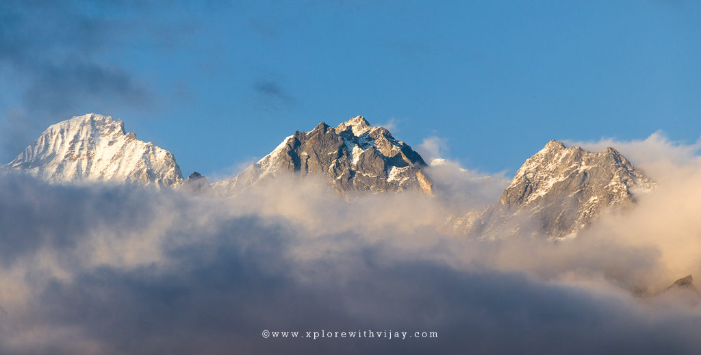
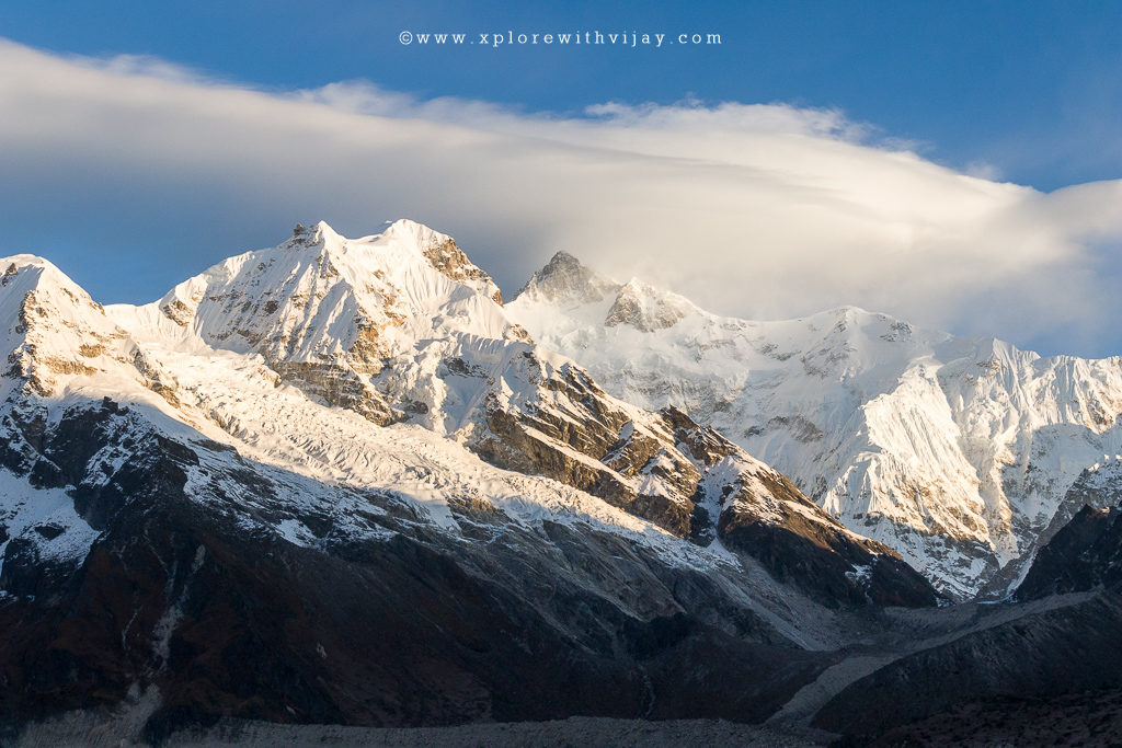
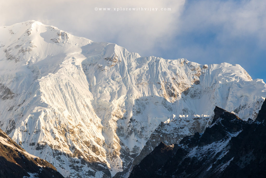
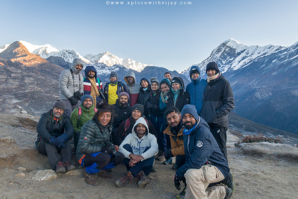
The day begins very early. A wake-up call at 3 AM in hostile weather conditions is a terrible thing to do. However, with all that one gets to experience a while later, this is worth doing! The destination for the day is at an altitude of 13,670 feet. Popularly known as Dzongri top, it offers stunning visuals of sunrise and closer views of Mount Kanchenjunga. Braving the hostile weather conditions, we hiked up for a duration of about 2 hours to reach the top. It’s like once in a lifetime experience! Believe me! It was visual extravaganza! Absolutely impressive! The prominent peaks visible from the Dzongri top are Kanchenjunga (8534 m), Kabru (7353 m) and Mount Pandim (6691 m). Add to this a splendid horizon! It’s a sight to behold! The rest of the day is reserved for relaxation. This is because of the extensive altitude gain the previous day. Your body needs to acclimatize well for the journey ahead! Typically, it is advisable to spend time outdoors, rather than laying inside the camping tent.
Day 6 – Excitement
It’s a day of rapid descend followed by steep ascend. We are going to be descending to about 1000 feet and then gain altitude to about 900 feet. All along the path, we were greeted with lush green meadows and dense rhododendron plantations. Although, these plantations bloom during the spring season, the sights of dense plantations were a delight to look at. Just before the midway, the deep forested area leading to Kokcharang has steep descend with huge boulders. I had to exercise extreme caution, keeping in mind by worn-out shoe soles and keeping my ankle from twisting. Kokcharang is at an altitude of about 12,000 feet and is a delightful location to spend time at. It’s a very small plateau-like place surrounded by dense plantations, narrow views of few mountains and its proximity to a river makes it an ideal spot for refilling water bottles! It’s a very ideal spot to sit back and relax in the lap of nature!
As soon as we crossed the river, the terrain was beginning to get tougher. Huge boulders and steep altitude gain was taking toll on my knees and ankle. After a 6-hour long hike, we were greeted by the beautiful campsite of Thansing at an altitude of 12,900 feet. It’s a flat ground surrounded by majestic mountains. Weather permitting, one can get clear views of Mount Kanchenjunga and Mount Pandim. The views are mesmerizing and a visual delight! By the fall of dusk, the temperatures dropped and intense cold waves had a grip over the region. The night temperatures dropped to negative 3 degrees Celsius.
Day 7 – Relaxed:
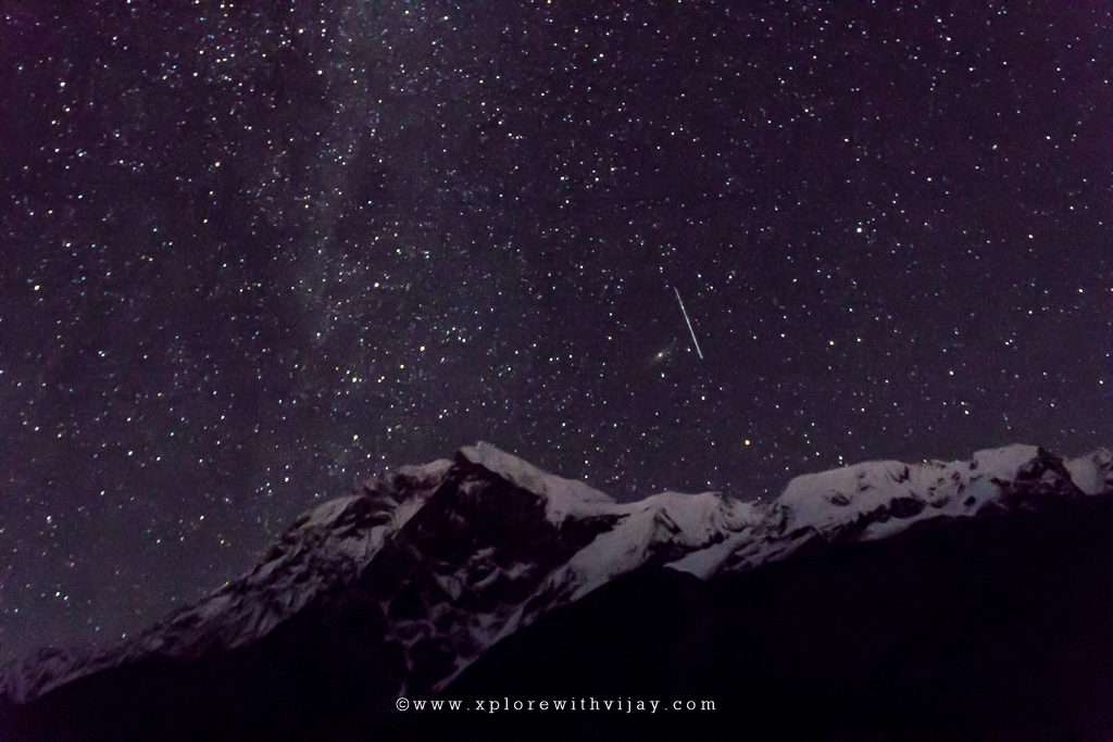
It’s a pretty relaxed day. The next camp (Lamuney) is at altitude of 13,660 feet. The trails gradually ascend. It’s among the easiest days and hiking was more of a fun activity. A major attraction is that the trekking trail is along the gushing river waters and several smaller streams. In less than 2 hours we were in our next campsite. The winds speeds were high and the recorded temperatures were down to 1 degrees Celsius. By the fall of dusk, the intensity of winds reduced and a clear sky prevailed. Being an adventure photographer, I love being at high altitudes. The clear skies paved way for an opportunity to photograph the beauty of night sky. While most of my friends were inside their respective camping tents, I was out in the cold capturing the spectacular night sky! Let me tell you that it was not easy being exposed to the cold weather. Though, I had to wake up very early the next morning, I was keen on getting fascinating night images. I was immensely happy to have obtained satisfactory images of the night sky!
Day 8 – Paradise:
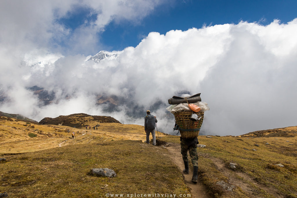
It’s the toughest and longest day. This is the D-day we have all been waiting to experience. The wake-up call was at 1 am. It’s a long and arduous incline to the incredible Goecha La view point at a staggering altitude of 15,100 feet. The reason for early start is to have enough time for both ascend and descend. Yes, we have to reach the view point and get back safely to the campsite. Also, the view of snow clad peaks reflecting the early light from the Sun is a magical experience. A little past 2 AM, we buckled up our respective backpacks and set forth on a remarkable journey to some of the magnificent locations on the planet!
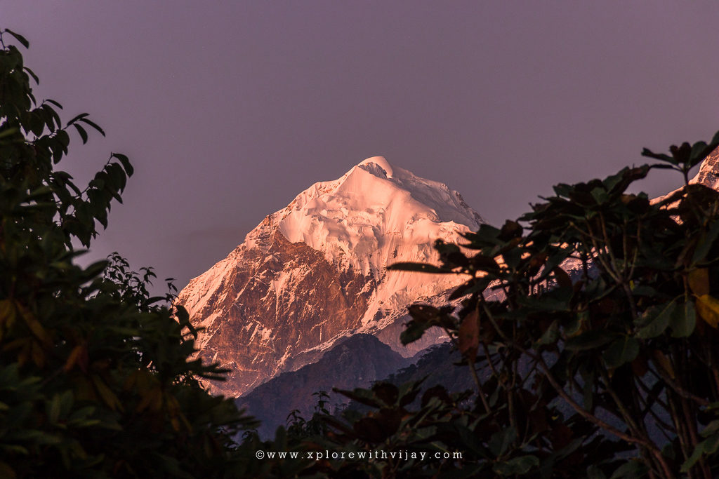
It was pitch dark, there was a steady flow of intense cold waves, and a steep incline to follow. Can you imagine how difficult and arduous the climb was? However, fierce determination and mental toughness played a pivotal role in keeping the focus on the climb. En route there was a lake named, Samiti, completely frozen. Although, it wasn’t visible during this time of the day, it indeed was a relief. Because this was the midway point and many of us got an opportunity to sip water and took a momentary rest for a minute or two. After 3 hours of stiff climbing, the nature greeted us with incredible views of surrounding peaks. We were, now, at a staggering altitude of 15,100 feet. The early light from the Sun reflected by the snow-clad peaks is a captivating sight. The peaks visible are Kabru South, Kabru North, Kabru Dome, Kangchendzonga, Gocha Jupano, Pandim, Sinvo and Tenzingkhang. We were lucky to have observed and experienced a clear view of the said mountain peaks. All thanks to the weather Gods!
After spending a considerable amount of time at the top, we began descending. As a rule of thumb, it is advisable not so spend more time at high altitudes. Lack of oxygen is bound to cause altitude sickness and, in some cases, the situation could go worse. The descend was equally tough. There’s a misconception that descend is easier. Practically speaking, descend is more dangerous and could be the reason for major fatalities. And, after 2 hours of steep descend we were at our campsite. The moods at the campsite was euphoric! Everyone was seen animated and happiness was all over on face! Obviously, for what each of us have achieved!
A brief rest and the campsite was vacated as we set forth to our lower campsite. It’s a long day. The distance to the next camp was 18 km. We were bypassing two campsites (Thansing and Dzongri). The trail downhill was a forest path moving from one mountain to the other towards the Rhododendron plantations and then the wooden log path takes over. A long back-breaking journey of over 9 hours came to a halt when we reached the picturesque campsite of Tshoka. As I settled in my camp, my knees, thighs, and ankle were asking for attention. Tired and exhausted, I soon fell asleep.
Day 9 – Exhaustion & Relief:
I was eagerly looking forward to this day. Having spent over a week’s time in isolation and completely cut-off from civilized world, this day was special! It was again a long day of descend covering a total of 15 km as we were bypassing another campsite too. The journey beyond the Sachen campsite is more of a hillock indicating the final few meters of trail. A 7-hour long downhill journey culminated when we arrived at the guest house in Yuksom. By this time, the mobile phones started picking up reception, indicating the end of a splendid time around the magnificent Himalayan terrains.
Day 10 – Adieu:
It was time to bid adieu to many wonderful people and location. By 8 AM, we commenced our journey back to Bagdogra/New Jalpaiguri in West Bengal and then, disperse to their respective home cities. A distance of about 150 km by road requires at least 8 – 9 hours. This trek will remain etched in my memory for many years! The best group I have been with yet! I wanted to write more, but keeping in mind the length of this blog, I have decided to put that off for now!
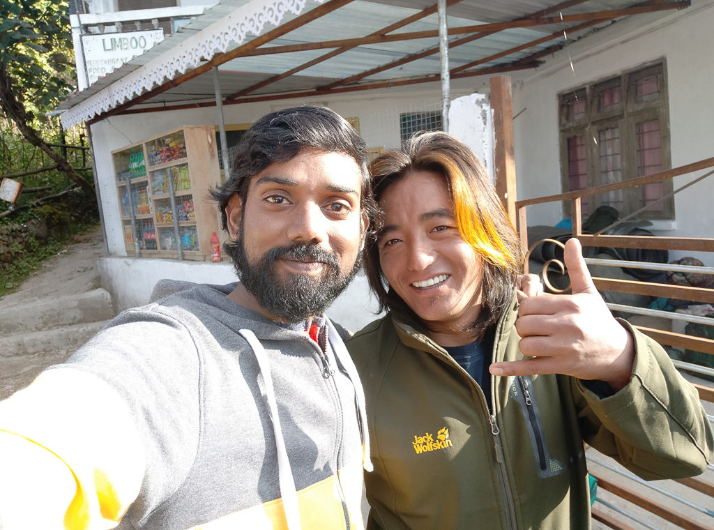
And, here’s the person I mentioned about earlier in this blog! We, fondly, called him Budha daju. Daju, in Nepali, is brother. He was the head-of-support- staff for this entire trek. He, alongside with his team, made us feel comfortable all through the trek. Always keeping a smiling face, humorous and serving sumptuous food, It was, indeed a great pleasure, for having spent time alongside such people! Wonderful hospitality that!
RESOURCES:
How Did I Travel?
Onward Journey:
- Flight: Chennai to Bagdogra
- Shared Taxi: New Jalpaiguri (3 km from Bagdogra) to Yuksom
Return Journey:
- Shared Taxi: Yuksom to New Jalpaiguri
- Train: New Jalpaiguri to Howrah
- Flight: Kolkata to Chennai
This entire sequence of trek, right from the pick up at New Jalpaiguri and back was organised by Trek the Himalayas (TTH). This was my second trek with TTH. Here’s the link to the first one! Having done several Himalayan treks with other companies, TTH’s way of serving clients was special! Their hospitality is something unique! And, I am thankful for it!
Having completed Seven Himalayan Treks is very Special!
Let me know if you liked this blog in the comments section below.
Feel free to share this blog with family and friends! Hit any of the social media icons you see on the screen to share this blog!
And, do subscribe to my travel blogs! So, you don’t miss out on many such fascinating travel stories!
Here’s a delightful trailer video of the entire journey!
Awesomely written. 🙂
I’m glad! Thank you very much, Kiran! 🙂
Let’s plan to meet with another trek later this year!
Awesome travelogue……I am very happy that I am also a member in this lovely trip …..
I’m glad! Thank you very much, KSN! 🙂
Let’s plan to meet with another trek later this year!
Lovely Vijay! Thanks for taking me down the memorable trek again with your blog.
I’m glad that you took time to read! Thank you very much, Shardool!
Let’s plan to meet with another trek later this year!
Fantastically written Trablog on one of the scenic areas of Indian Northeast. Feels surreal! Thanks for the memories.
Thank you very much, Sachin sir! I’m glad that you took time to read! I will cherish this feedback!
Let’s plan to meet with another trek later this year! 🙂